Mountain Toubkal Climb Trek -2 Days
Itinerary
Day 1. Drive from Marrakech to Imlil and trek to Toubkal Refuge via Aremd & the Mizane Valley
Leaving the city behind we drive south today, towards the craggy peaks and plunging valleys of the Toubkal Massif. Crossing the Haouz Plain we pass through the tiny town of Asni, from where our road begins to climb towards the foothills of the Massif. Below us the valley of the Oued Rhirhaia stretches out into the distance and small villages cling to the sides of the steep hills as we meander
our way towards the village of Imlil. Here we leave our vehicle and, in the company of our mountain guide, begin our trek, heading along the Mizane Valley, first towards the village of Aremd and then onto the shrine of Sidi Chamarouch. Built on a moraine spur overlooking the valley floor, Aremd is the largest village in the valley and provides an interesting mix of traditional terraced farming, gites and streets that seem to be permanently gridlocked by goats and cattle. For generations the local Berber villagers have worked these lands, producing corn, potatoes and walnuts from the harsh landscape. Continuing east and crossing the flood plain our route takes us along mule tracks and up into the high rocky cliffs above the valley. Crossing the river we eventually come to the pastoral shrine of Sidi Chamarouch, which attracts tourists and pilgrims alike (although only Muslims are allowed to cross the stone bridge to visit the marabout shrine itself). The village sits besides a small waterfall, a jumbled cluster of houses that seem to melt together into an anarchic mass. From here the trail continues to climb steadily, snaking and zigzagging its way up to the
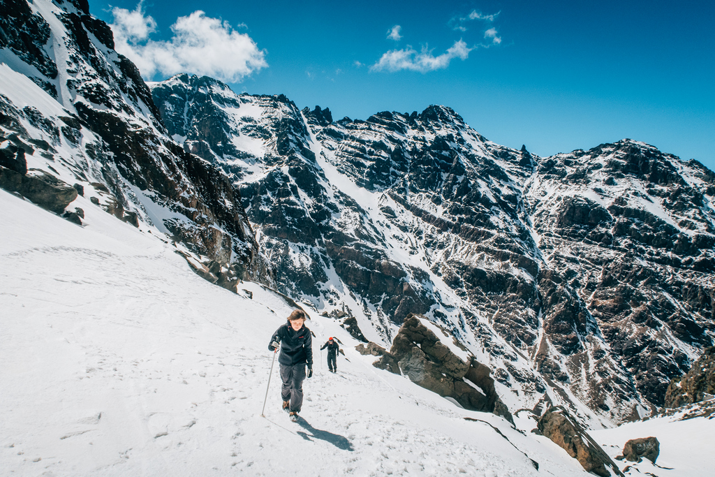
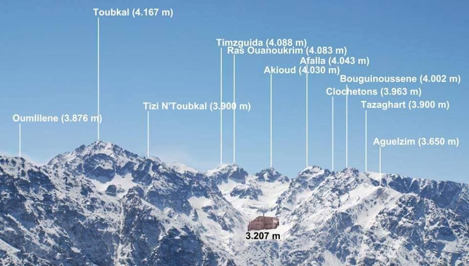
snowline and the Toukbal Refuge (3206m), our stop for the night. Approx 5hrs walking.
Day 2. Trek to summit of Jebel Toubkal(4165m); return to Imlil :
Early this morning we make our attempt on the summit of Jebel Toukbal, the highest peak in Northern Africa. Our route takes us up the south cirque, crossing the stream above the refuge and then heading across one of the
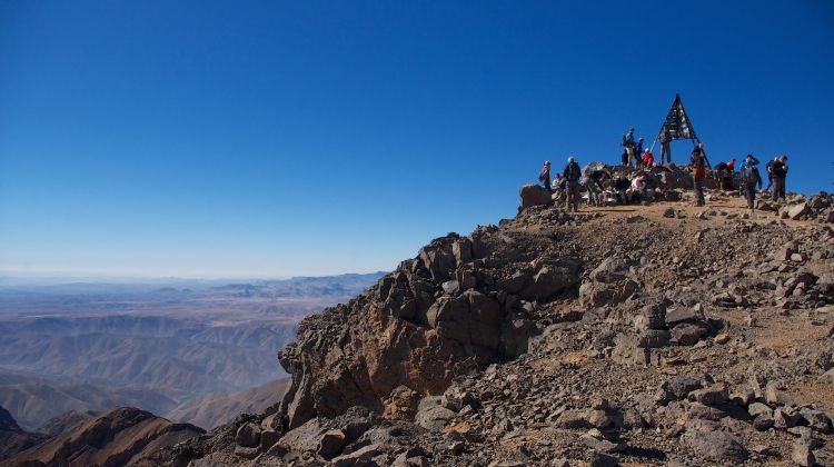
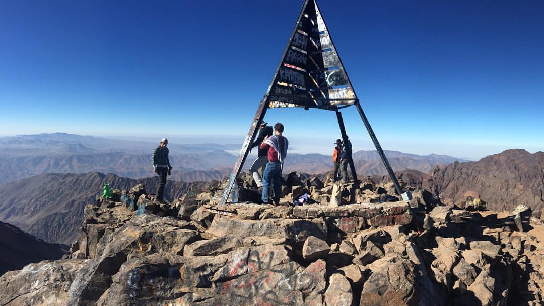
mountains numerous scree fields, where we will have to negotiable a seemingly endless carpet of boulders and rocks. The walking is relatively straightforward, but the scree and the altitude will make the going quite difficult in parts, however, the views along the way make the journey more than worthwhile. Cresting the ridgeline we find ourselves on the plateau, from where it is a short walk to the summit and the vistas out across the surrounding landscape are quite breathtaking. From here there are unrestricted views in every direction, from the Marrakesh Plain to the High Atlas in the north and as far south as the Anti-Atlas and the Sahara. Pliny, the great Roman scholar, once described the High Atlas Mountains as “the most fabulous mountains in all of Africa” and from our vantage point high above the valley it is easy to understand why. Retracing our steps we then return down the mountain and head back towards Imlil Prior To drive back to Marrakech
Trip Facts
Duration: 2 Day(s)
Trip Grade: Challenginng
Trip Cost: On request
Destination: High Atlas Mountains
Best Season : April to November
Transportation : Private Vehicle
Maximum Altituted: 4,167 m/ 13671,26 ft
Group Size: Min 2 person,


Tyler Bailey
13 August 2019Lorem ipsum dolor sit amet, consetetur sadipscing elitr, sed diam nonumy eirmod tempor invidunt ut labore et dolore magna aliquyam erat, sed diam voluptua. At vero eos et accusam et justo duo dolores et ea rebum. Stet clita kasd gubergren, no sea takimata
Eliza Jordan
17 SEP 2019Lorem ipsum dolor sit amet, consetetur sadipscing elitr, sed diam nonumy eirmod tempor invidunt ut labore et dolore magna aliquyam erat, sed diam voluptua. At vero eos et accusam et justo duo dolores et ea rebum. Stet clita kasd gubergren, no sea takimata